December 2, 2015
Submitted by Reveal Mobile
Reveal Mobile has detected and classified over 100,000 Bluetooth beacons in the United States. How?
The Reveal Mobile SDK sits inside a few hundred news and weather apps across the country, touching millions of mobile devices monthly. As smartphones bump into any beacon, we detect that beacon bump. If the user chooses to share location with the app, we see the latitude and longitude of where that bump occurred.
After enough location-sharing devices bump into that beacon over a certain time window, we triangulate the position of the beacon and classify it by the business type that it belongs to. We'll spare you the mathematics and the patent-pending algorithms for now. The end output is a mobile audience platform for better product development and much more effective and profitable mobile advertising.
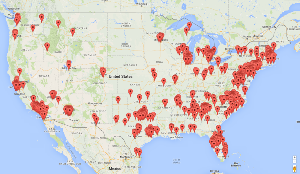
Now the fun part...below is a map of every unique location where we've seen a beacon, or multiple beacons, in the last 30 days. The data is influenced by two primary factors.
- We detect the most beacons where we have the most people using apps with our SDK inside. This user base is concentrated in most major markets across the U.S.
- We detect beacons only where they exist!
While there may be beacons deployed in the Dakotas, we haven't seem them yet.
We see clusters in the big cities and along the East Coast / I-95 corridor. What do you see?
Our goal is to expand this beyond a static screenshot to an interactive map in the next few months.
